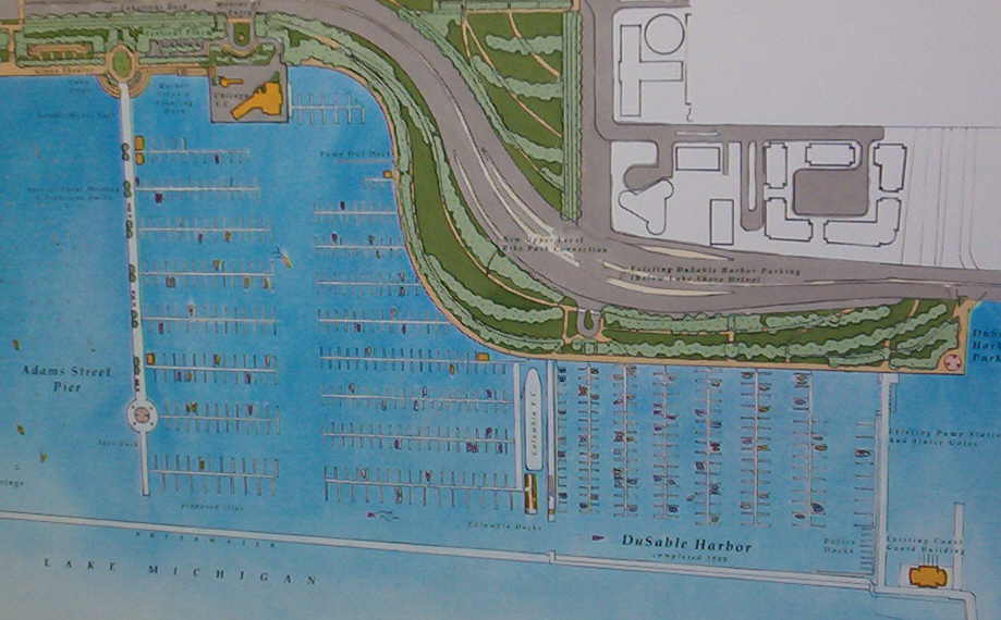
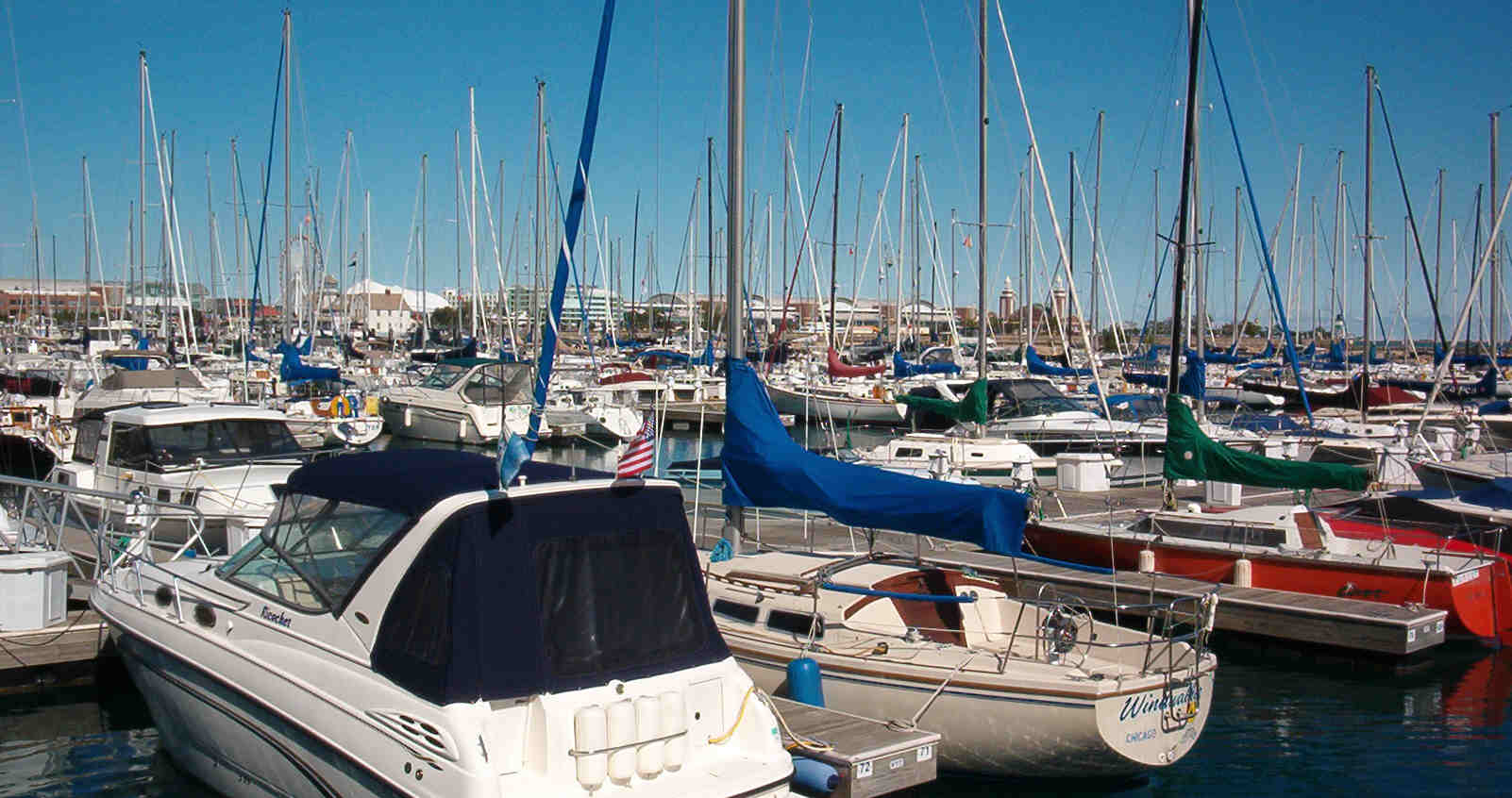
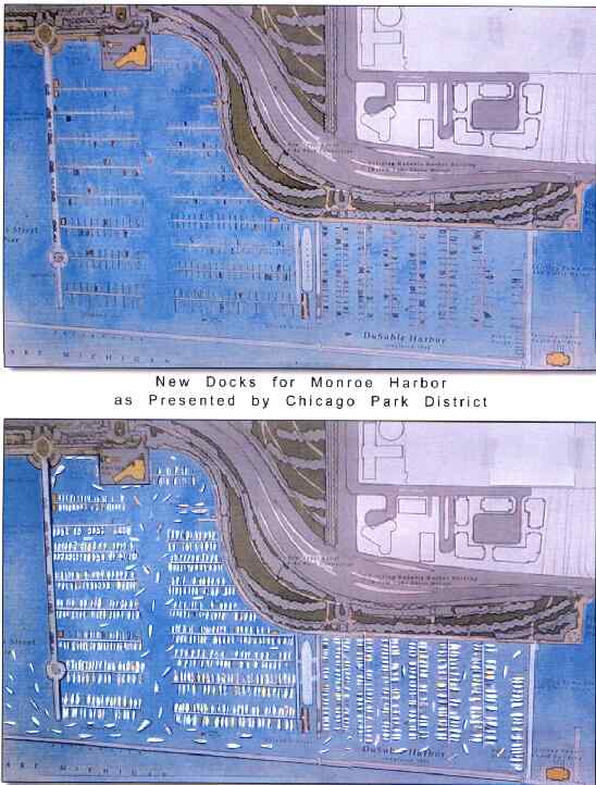
95% of the boats are missing from this park district graphic.
We are being asked by the park district what we think of their idea. This website will give you an opportunity to register your opinion, and we will insure that the park district officials receive your input. You can write privately to them or use the more public forum of this Guest Book..........>
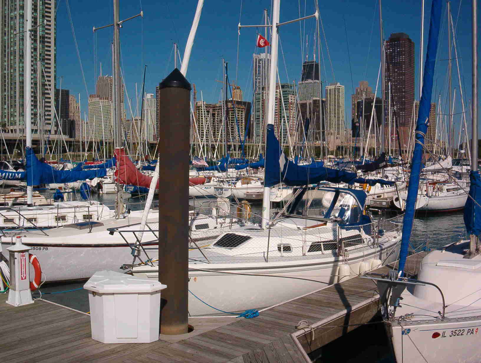
If you walk out on the pier next to the Columbia, you can get a clear view of both "before and after" from the exact same spot. Look northwest and the existing DuSable Marina is similar to what the park district wants to do to Monroe Harbor - (although the Monroe "Marina" would be twice as wide - and therefore, appear to be a greater "obstruction" to your view of the open water).
It is your choice....
Please share your opinion.
Page Visits
To Earlier Monroe Harbor Graphics
To NewEastside.ORG Homepage Index
MONROE HARBOR DEBATE
The reasons for NOT changing Monroe Harbor
For all of recorded history, the Lake Michigan water to the east of Chicago has been open, clear, free, and not obstructed.
More "recently", in 1836, the Canal Commissioners were charged by the new State of Illinois to sell land to obtain funding for a canal from the South Branch of the Chicago River (approximately from the current Kedzie and 35th Streets, 6 miles southwest to Harlem and 47th Streets) to meet the Des Plaines River. That would eliminate the required portage across Mud Lake, and effectively connect the Atlantic Ocean with the Gulf of Mexico. They would be selling over 500 square miles of land that had been donated to llinois by the Federal government. But they saved the lakefront from Madison to 12th for all the people of Illinois, by inscribing a dedication restriction (covenant) on the original plat of Chicago:
"Public Ground - A Common to Remain Forever Open, Clear
and Free of any Buildings, or Other Obstruction whatever."
Nothing has had a more profound effect on the City of Chicago. For the last 167 years, there have been numerous attempts (usually by our own elected officials) to use the free, open and available land for all sorts of buildings and obstructions. The Illinois Supreme Court has had to order buildings and obstructions to be torn down. In a series of decisions, our courts have upheld the covenants and have declared that they could not be changed or condemned...and that the restrictions applied to the submerged lands out to the seawall (including our unobstructed view of Monroe Harbor).
A new challenge is again being made to the "dedication restrictions". The park district wants to obstruct the northern third (approx. 30 acres) of Monroe Harbor with a permanent 1500 foot pier, and 900 permanent finger slips. And, of course, that will include leasing the slips to private boat owners for 900 boats, also contrary to the Supreme Court decisions.
The park district has made several presentations using graphics that omit over 95% of the boats. They may hope that we will not notice that they are missing.
This page was last updated on: June 14, 2008
Please revisit this page to view the entries in the Guest Book by your neighbors.
We will also continue to add to this webpage as more ideas are presented by both sides of this debate in the coming months. Your condominium boards and management should make their "representative opinions" known to the park district officials.
OR TO REMAIN OPEN AND UNOBSTRUCTED
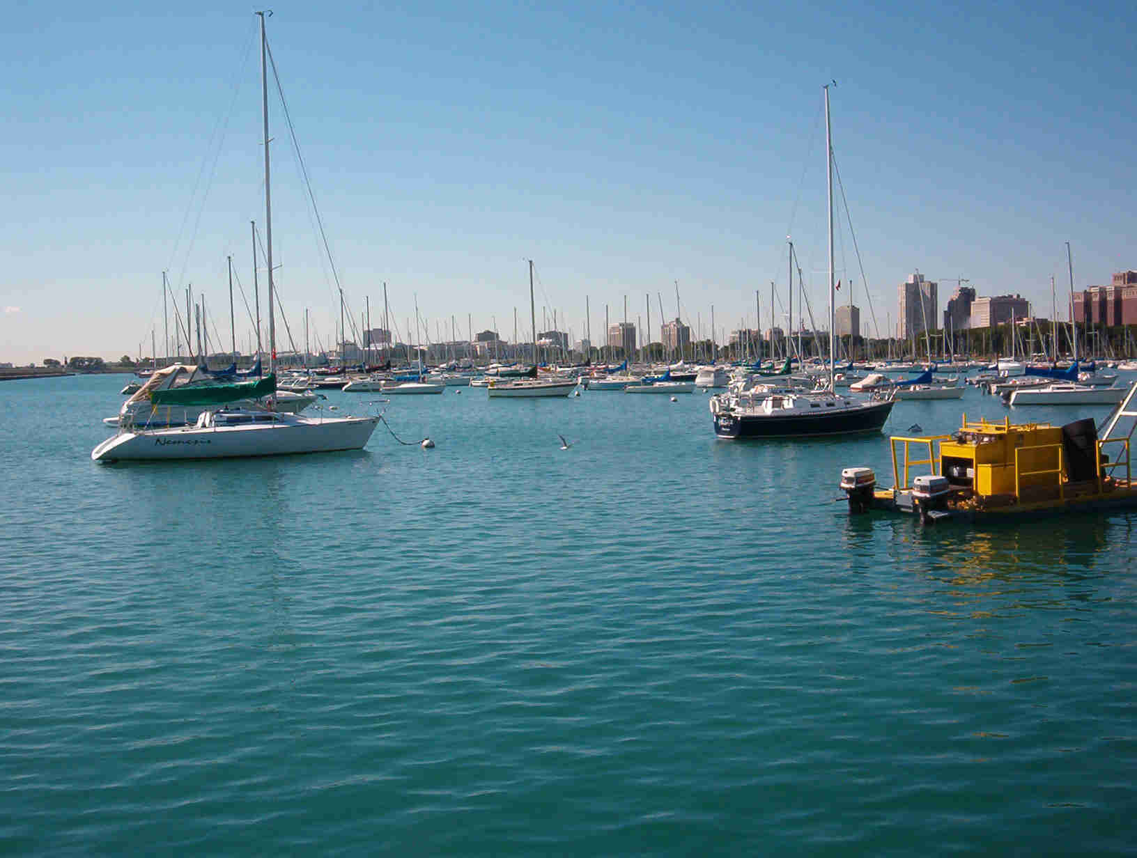
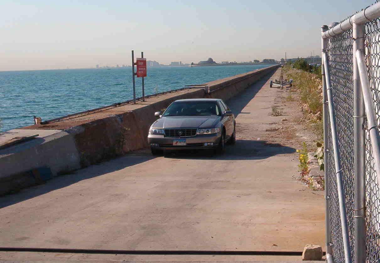
For a mere $200,000, the U.S.Army Corps of Engineers want to repave the breakwater and open it to the public (that's all of us). Then we can walk all the way out to the lighthouse for the beautiful view of an "open" Monroe Harbor with Buckingham Fountain and the Chicago skyline in the background. This alternative certainly beats spending $30 million for 900 locked privately-leased boat slips that obstruct the public's view of the water.
Lighthouse
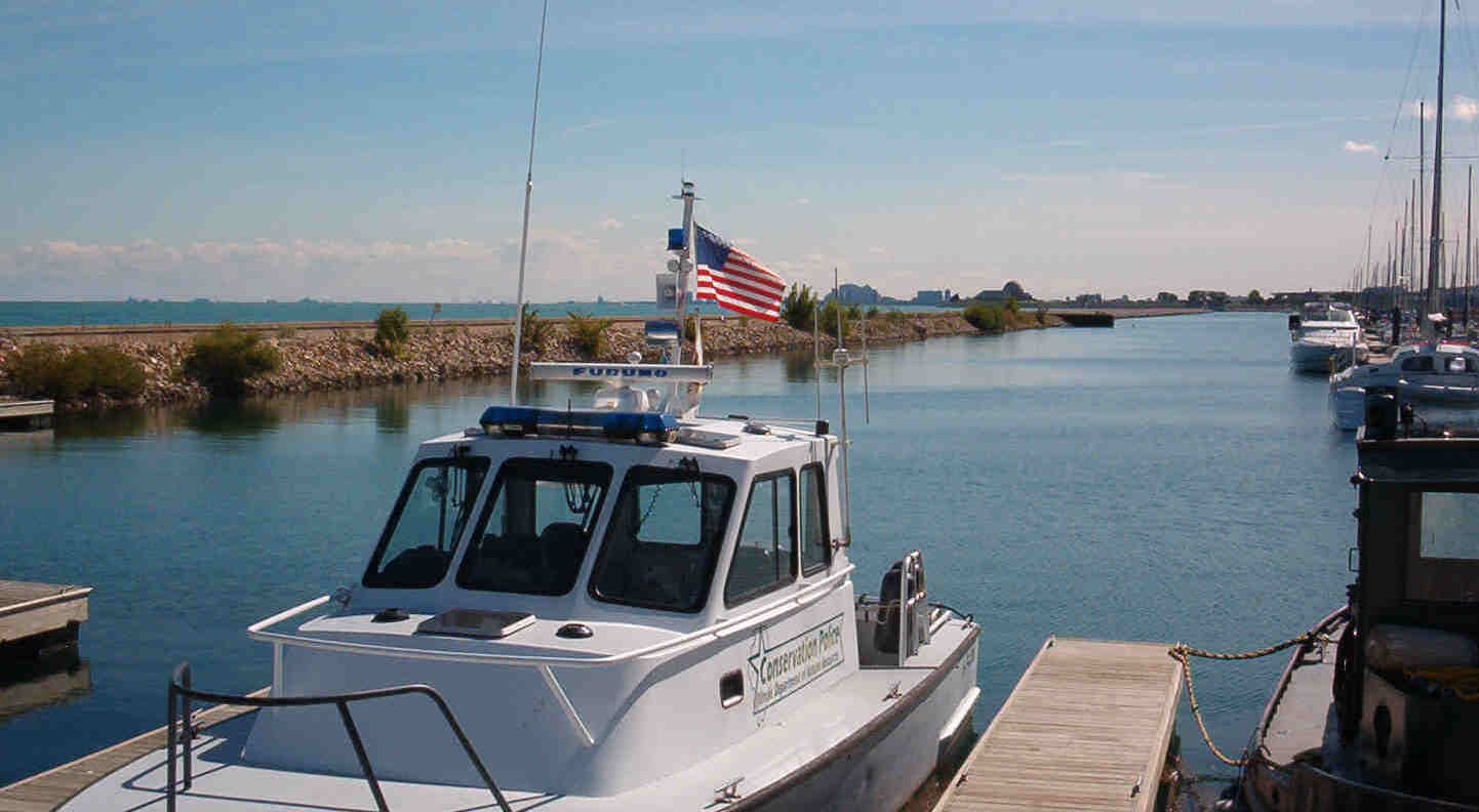
This is the view from where the proposed 1500-foot "Adams Pier" and 900 filled boat slips would be attached....The 1836 and 1839 Dedication Restrictions (or Covenants) that have been upheld 4 times by the Illinois Supreme Court still protect this view of the water for the public from this point on the shoreline. The courts have concluded that these "dedication restrictions" cannot be changed or avoided by the Illinois Legislature, Cook County Board, Chicago City Council, or the Chicago Park District.
This is the current view of the walkway to the lighthouse that just needs to be repaved to make it safe for the public to enjoy. Also fishermen report that when this was open many years ago, the fishing was great on the harbor side of the breakwater.
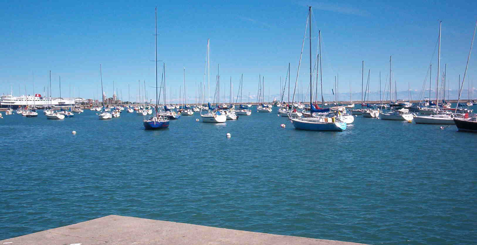
This view of DuSable Marina is similar to what a Monroe Marina would look like....and what many citizens, residents, and some boaters are trying to avoid in our "historically and legally open" Monroe Harbor - the frontyard of Chicago........... Can you find the "view of the water" in this picture that would be legally guaranteed in our frontyard harbor?(Hint - You can see a little patch in the lower right and lower left corners...and just behind the flag. You can barely see the buildings of Navy Pier through the masts.)
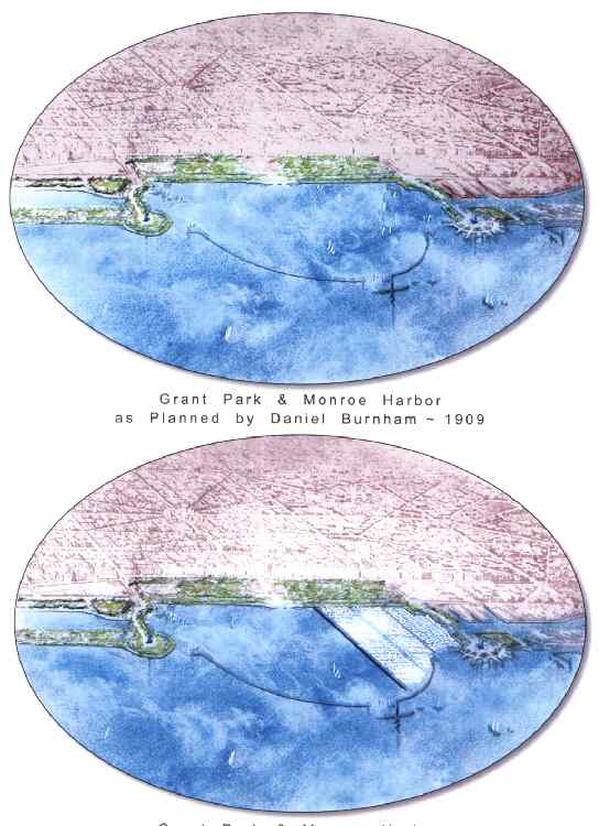
A few supporters of the Monroe Marina idea have stated at public meetings that the 1909 Burnham Plan of Chicago included a marina in Monroe Harbor.
This actual graphic from Burnham's plan shows no permanent marina in the enlarged harbor - only a few boats are shown, either sailing or on bouys.
We wanted to show you what Burnham's 1909 Plan of Chicago would look like with the permanent pier and slips that have been proposed today by the park district in the northern third of Monroe Harbor.
Burnham's office was on the top floor of the Santa Fe building in the northeast corner (green star). He would not have been pleased with the symmetry of this 2003 idea.
This is the same picture that appears at the top of this page.
It is the park district's graphic that they have been using from May to Oct. of 2003 that carefully has omitted 95% of the boats from the Monroe Marina proposal. They even omitted 88% of the boats from the current DuSable Marina to make the water appear less "obstructed from view".
But we knew that you would like to make a more accurate comparison, so we added the missing boats.
Of course the park district would not show these boats, because you might be upset that so much of the surface of the water is obstructed. (We use the word "obstructed" because that is what is prohibited in the legal covenant.)
Please compare both marinas (filled with boats) with the open contrast of the remaining 2/3 of Monroe Harbor to the left of the graphic.
And this birds-eye view is the best view. As you have seen from the ground level pictures above, the view of the water is almost totally "obstructed".(There's that word again.)
155
175
195
400
To the Other Monroe Pictures and Graphics (May,2003)
Please don't forget to leave your comments in the GUESTBOOK above. We will share them with the park district board members.
AND/OR click on the Friends of Monroe Harbor site and fill in the ONLINE PETITION. It is only with your support that we will keep our frontyard open, at least until our future representatives have another bad idea.